Transportation drives resident interest
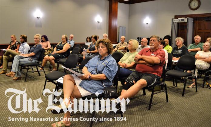
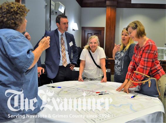
The City of Navasota’s long range Thoroughfare Plan and the more recent Pedestrian and Bicycle System Plan public meeting attracted significant attendance Tuesday, Aug. 10. Some residents shared suggestions and/or criticisms during public comments while others marked suggested routes and paths on the maps provided.
Thoroughfare plan key components
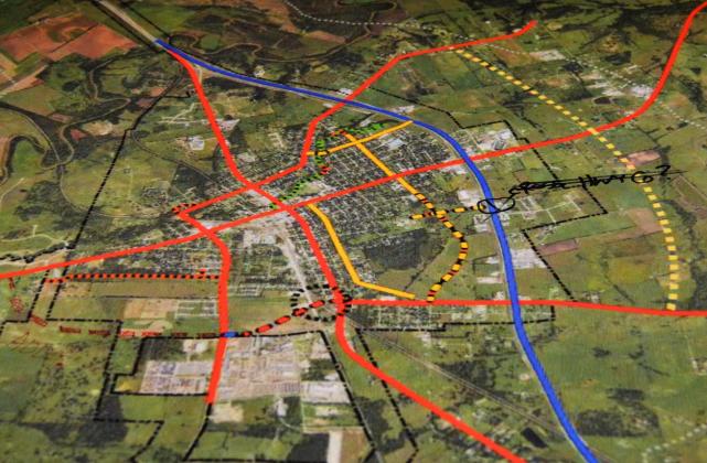
Opening with the Thoroughfare Plan, Strand Associates Project Manager Jeff Held said, “What this document really does is that it lays out the hierarchy of streets of the city. It notes additional new connections to be made and helps the City understand the type of connections, whether it’s an arterial, or a higher volume street, or a collector and the type of right of way that would be needed so hopefully that can be reserved as development occurs.”
Key components discussed included the east arterial, the Spur 515 grade separation, the extension of Judson Street to Spur 515 and Manley Street to the SH 6 feeder, and a possible reconfigured Fifth Street at Blackshear.
The proposed arterial east of SH 6 would be a two-phase project with phase one running from SH 105 E. to SH 90 and phase two from SH 90 to FM 3090.
While there were three options for the Spur 515 proposal, all three were designed with the grade separation after both railroad tracks converge.
Downtown traffic operations
Addressing modeling and traffic forecasts at LaSalle Street and Washington Avenue, Held said, “The delay in level of service is a fairly acceptable level of service of ‘C,’ or a tolerable amount of delay at the signal. But the queuing or backups from the traffic get pretty bad in future positions so that eastbound traffic backs up 1,700 to 2,100 feet according to the models. That’s getting to be a very long backup.”
Of the options proposed, the recommended alternative was to extend the eastbound left turn bay to Farquhar.
Other options included realigning LaSalle Street which would require the removal of a building on the northeast corner, squaring up the crosswalk, or crossing pedestrians in the center which allows the signals to run turns which don’t conflict with pedestrians.
Crash record
According to crash analysis at five intersections, none had significant issues that would require improvements. Held pointed out that the intersection of N. LaSalle and Blackshear Street had a little higher crash rate but vegetation might be the cause.
SH 6 was evaluated by the type and number of crashes, and Held suggested that access control by consolidating driveway might be a solution.
Washington Avenue, however, had two sections close to downtown above statewide averages and three areas close to SH 6 which were double the statewide average.
Bicycle and pedestrian plan
Held explained that the plan’s goal is to address safety, improve walkability, offer bike route options and to connect neighborhoods to city services, schools, medical and recreational facilities.
He added, “It’s also in the City’s Comprehensive Plan and the City’s Comprehensive Plan talks quite a bit about improving conditions for bicycles and pedestrians so this plan, hopefully, provides the framework.”
Held gave an overview of auto-bike-pedestrian shared use options, as well as pedestrian paths and trails with the accompanying lighting and surface materials.
Referring to the TxDOT’s TAP (Transportation Alternatives Program), Held said that residents at the May public meeting favored sidewalks over bike lanes. As a result, on-street bike lanes on Washington Avenue were removed from the TAP grant submission. Sidewalk improvements on the west side were proposed in the grant, paving the way for shared-use lanes on FM 379 in the future.
Resident input
A half dozen residents weighed in with comments which included the need for a sidewalk from Annie’s and McDonald’s to Navasota High School, from Ace Hardware past Oakland Cemetery to Blackshear Street and Blackshear in general, and concerns about traffic backup on Washington Avenue because of trains, and increased traffic on N. Business 6 resulting from a new subdivision.
Another suggestion was to add surface area to sidewalks leading to parks in order to provide space for hopscotch or painted checkerboards.
Responding to a request for data on the number of pedestrians and bicyclists, Held said that despite the ability to track people through cellphone data, “It’s pretty spotty on pedestrians and bikes. The best way to do it still is to send out surveys.”
When asked about locations for bike boulevards, Held replied that proposals include areas further out from the downtown area and that McAlpine is parallel to Washington Avenue for a “nice long stretch and a better place for bikes to be.”


